Section 6: Aviation Weather Theory & Weather Services
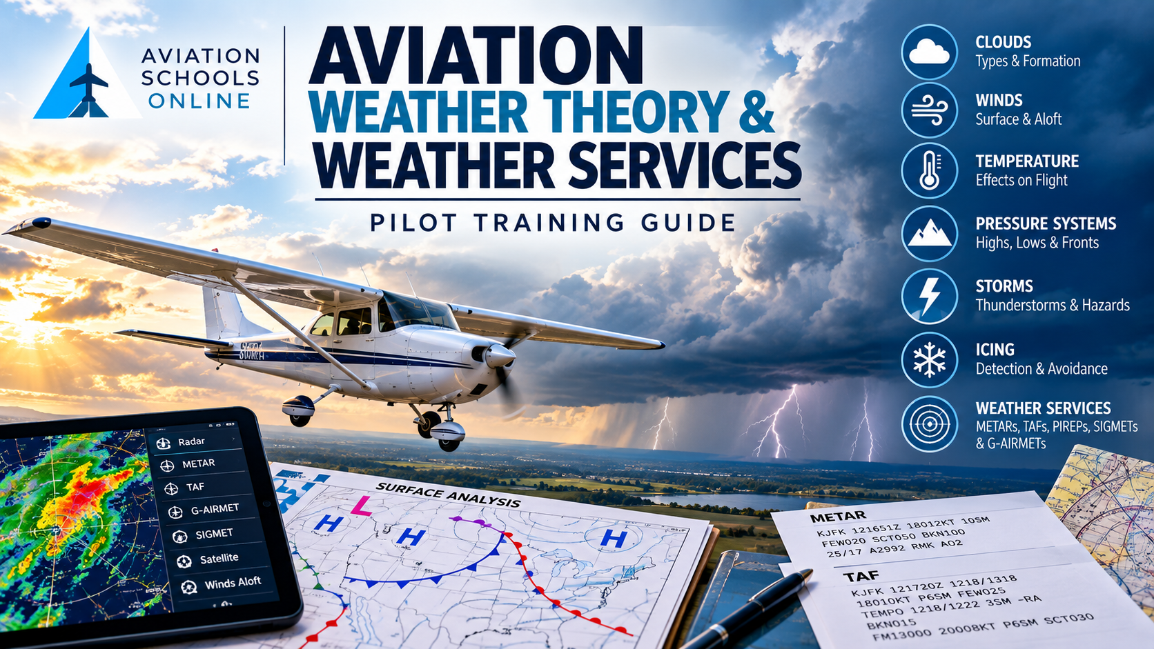
Section 6: Aviation Weather Theory & Weather Services
Weather is one of the most important variables in aviation. It affects aircraft performance, visibility, route selection, fuel planning, turbulence exposure, icing risk, thunderstorm avoidance, takeoff and landing decisions, and whether a flight should be conducted at all.
For student pilots, understanding aviation weather requires two complementary skills:
Weather theory — understanding how the atmosphere behaves and why weather develops.
Weather services — knowing where to obtain reliable observations, forecasts, advisories, and pilot reports before and during flight.
For 2026, the FAA’s principal reference is FAA-H-8083-28B, Aviation Weather Handbook, published in April 2026. The FAA describes it as a consolidated resource covering U.S. aviation weather services, weather theory, aviation hazards, and aviation weather products. (Federal Aviation Administration)
Why Aviation Weather Knowledge Matters
Pilots operate within a constantly changing atmosphere.
Even relatively short flights may encounter changes in:
-
Wind
-
Visibility
-
Cloud cover
-
Temperature
-
Atmospheric pressure
-
Precipitation
-
Turbulence
-
Icing
-
Thunderstorm activity
Weather can also change rapidly between departure and destination.
A strong understanding of weather helps pilots evaluate whether conditions are appropriate for the aircraft, pilot qualifications, terrain, route, and mission.
The goal is not simply to determine whether the weather is technically legal.
Good aeronautical decision-making asks a broader question:
Does the weather provide an adequate safety margin for this flight?
The Atmosphere
Earth's atmosphere is made up primarily of nitrogen and oxygen, along with smaller quantities of other gases and water vapor.
Most day-to-day aviation weather occurs in the troposphere, the lowest major layer of the atmosphere.
Within the troposphere, temperature generally decreases as altitude increases, although actual atmospheric conditions may vary significantly.
Changes in temperature, pressure, moisture, and air movement create the weather pilots experience.
Atmospheric Pressure
Atmospheric pressure is the force exerted by the weight of the atmosphere.
Pressure normally decreases as altitude increases.
Pilots encounter atmospheric pressure in several important ways, including:
-
Altimeter settings
-
Pressure altitude calculations
-
Density altitude calculations
-
Weather analysis
-
Pressure systems
-
Wind patterns
Weather maps commonly show areas of high pressure and low pressure.
High-Pressure Systems
High-pressure systems are generally associated with descending air.
Descending air tends to inhibit cloud development, which is why high pressure is often associated with relatively stable weather and clearer skies.
However, pilots should not assume that high pressure always means ideal flying weather.
High-pressure conditions can also contribute to:
-
Haze
-
Temperature inversions
-
Reduced visibility
-
Fog
-
Strong winds around pressure gradients
Weather must always be evaluated based on actual observations and forecasts.
Low-Pressure Systems
Low-pressure systems are generally associated with rising air.
As air rises, it expands and cools.
If the air cools to its saturation point, clouds and precipitation may develop.
Low-pressure systems can therefore be associated with:
-
Clouds
-
Precipitation
-
Reduced visibility
-
Strong winds
-
Frontal activity
-
Turbulence
-
Thunderstorms
The specific weather depends on the system, moisture availability, temperature, terrain, and other atmospheric factors.
Wind
Wind is the horizontal movement of air.
Differences in atmospheric pressure are one of the primary forces that cause air to move.
Pilots should understand several forces that influence wind, including:
-
Pressure gradient force
-
Coriolis effect
-
Surface friction
Near the Earth's surface, friction affects both wind speed and direction.
Winds aloft may differ substantially from surface winds.
This is why pilots review both airport surface winds and winds aloft during flight planning.
Temperature
Temperature affects both weather formation and aircraft performance.
Warm air is less dense than colder air under comparable pressure conditions.
Temperature affects:
-
Density altitude
-
Engine performance
-
Propeller performance
-
Lift
-
Cloud formation
-
Atmospheric stability
-
Icing potential
-
Thunderstorm development
Pilots should understand not only the surface temperature but also how temperature changes with altitude.
Temperature Inversions
A temperature inversion occurs when temperature increases with altitude through a particular atmospheric layer.
Inversions can trap:
-
Haze
-
Smoke
-
Pollution
-
Moisture
This can reduce visibility near the surface.
Temperature inversions are also relevant when evaluating wind shear, turbulence, and atmospheric stability.
Moisture and Humidity
Water vapor is essential to cloud, fog, precipitation, icing, and thunderstorm formation.
Important moisture concepts include:
-
Relative humidity
-
Dew point
-
Saturation
-
Condensation
The dew point is the temperature to which air must be cooled for saturation to occur, assuming pressure and water-vapor content remain appropriate for the definition.
When temperature and dew point move closer together, the air is approaching saturation.
A small temperature-dew point spread can therefore be an important warning sign for possible:
-
Fog
-
Low clouds
-
Reduced visibility
Clouds
Clouds form when moist air becomes saturated and water vapor condenses or freezes onto microscopic particles.
For pilots, clouds provide valuable information about atmospheric stability and moisture.
Cloud types commonly encountered in aviation include:
-
Cumulus
-
Stratus
-
Cirrus
-
Cumulonimbus
Different cloud formations may indicate very different flying conditions.
Cumulus Clouds
Cumulus clouds commonly form from rising air.
Small cumulus clouds may indicate ordinary convective activity.
Rapidly growing cumulus clouds, however, can indicate increasingly unstable conditions.
When sufficient instability and moisture are present, cumulus clouds may develop vertically into thunderstorms.
Stratus Clouds
Stratus clouds generally form in relatively stable air.
They can cover large areas and may be associated with:
-
Low ceilings
-
Mist
-
Drizzle
-
Reduced visibility
For VFR pilots, widespread low stratus can create significant operational limitations even when severe weather is absent.
Cumulonimbus Clouds
Cumulonimbus clouds are thunderstorms.
They represent one of the most significant weather hazards in aviation.
Thunderstorms may contain:
-
Severe turbulence
-
Lightning
-
Hail
-
Heavy precipitation
-
Strong surface winds
-
Wind shear
-
Microbursts
-
Icing
-
Tornadoes
Thunderstorm avoidance is a fundamental part of aviation weather planning.
Atmospheric Stability
Atmospheric stability describes the atmosphere's tendency to resist or encourage vertical motion.
Stable Air
Stable atmospheric conditions may produce:
-
Smooth air
-
Stratiform clouds
-
Poor visibility
-
Steady precipitation
-
Fog
Unstable Air
Unstable atmospheric conditions may produce:
-
Turbulence
-
Cumulus clouds
-
Showery precipitation
-
Thunderstorms
-
Better visibility outside precipitation
Understanding stability helps pilots anticipate the type of weather that may occur.
Air Masses
An air mass is a large body of air with relatively uniform temperature and moisture characteristics.
Air masses generally acquire their characteristics from the geographic areas over which they form.
Examples may include:
-
Continental polar
-
Maritime polar
-
Continental tropical
-
Maritime tropical
When different air masses interact, significant weather can develop.
Weather Fronts
A front is a boundary between air masses with different characteristics.
Pilots commonly encounter four primary types.
Cold Front
A cold front occurs when advancing colder air displaces warmer air.
Cold fronts may produce:
-
Rapid weather changes
-
Gusty winds
-
Turbulence
-
Showers
-
Thunderstorms
-
Wind shifts
Weather associated with cold fronts can be intense.
Warm Front
A warm front occurs when warmer air advances over colder air.
Warm fronts may produce broad areas of:
-
Layered clouds
-
Precipitation
-
Reduced visibility
-
Low ceilings
Weather may extend a considerable distance ahead of the surface front.
Stationary Front
A stationary front forms when neither air mass is advancing significantly.
These fronts can produce prolonged periods of:
-
Clouds
-
Precipitation
-
Poor visibility
Occluded Front
An occluded front forms when a faster-moving cold front overtakes a warm front.
Occluded systems may produce complex weather, including extensive clouds, precipitation, and changing winds.
Fog
Fog is essentially a cloud at or near the Earth's surface.
Fog is especially important to pilots because it can rapidly reduce visibility and ceilings.
Common types include:
-
Radiation fog
-
Advection fog
-
Upslope fog
-
Steam fog
-
Precipitation-induced fog
Fog formation depends on moisture, temperature, wind, terrain, and atmospheric stability.
Turbulence
Turbulence is irregular air movement that can affect aircraft control and passenger comfort.
Sources include:
-
Convective activity
-
Mountain waves
-
Strong winds
-
Jet streams
-
Wind shear
-
Mechanical turbulence
-
Frontal systems
Turbulence intensity can range from light to extreme.
Pilots should review forecasts and reports along the entire planned route.
Mountain Waves
Mountain waves can form when strong winds flow across mountainous terrain.
These conditions may create:
-
Strong updrafts
-
Strong downdrafts
-
Turbulence
-
Rotor activity
Lenticular clouds can sometimes indicate mountain-wave activity.
Mountain-wave conditions deserve particular attention when flying near or across mountain ranges.
Wind Shear
Wind shear is a change in wind direction and/or speed over a relatively short distance.
Wind shear can occur:
-
Near thunderstorms
-
Along fronts
-
Near temperature inversions
-
Around terrain
-
Near the surface
Low-level wind shear is particularly important during takeoff and landing because aircraft are close to the ground.
Microbursts
A microburst is an intense localized downdraft that spreads outward after reaching the ground.
Microbursts can cause rapid changes from:
-
Headwind
-
Downdraft
-
Tailwind
This sequence can create a severe loss of aircraft performance during takeoff or landing.
Microbursts are commonly associated with convective activity and must be treated seriously.
Aircraft Icing
Aircraft icing can occur when supercooled liquid water droplets strike an aircraft and freeze.
Structural icing may significantly affect:
-
Lift
-
Drag
-
Stall characteristics
-
Aircraft controllability
Common classifications include:
-
Rime ice
-
Clear ice
-
Mixed ice
Induction icing and instrument icing may also occur under certain conditions.
Icing potential is a critical part of weather planning, particularly for aircraft without approved ice-protection capabilities.
Thunderstorms and Convective Weather
Thunderstorms require three primary ingredients:
-
Moisture
-
Unstable air
-
A lifting mechanism
Thunderstorms typically progress through three stages.
Cumulus Stage
The storm is dominated primarily by rising air.
Mature Stage
Both updrafts and downdrafts exist.
This is generally the most hazardous stage because it can contain heavy precipitation, turbulence, lightning, hail, and severe wind conditions.
Dissipating Stage
Downdrafts dominate and the storm gradually weakens.
Even dissipating thunderstorms may remain dangerous.
Aviation Weather Services
Understanding weather theory helps a pilot understand why weather develops.
Weather services provide the observations, forecasts, and advisories needed to determine what the atmosphere is actually doing and what it is expected to do next.
The FAA notes that pilots now have extensive access to aviation weather through internet-based products and self-briefing tools, but pilots should evaluate the type, currency, validity, and relevance of the information being used. (Federal Aviation Administration)
Aviation Weather Center
The National Weather Service Aviation Weather Center, commonly called AWC, is one of the primary official sources of aviation weather information in the United States.
Its current website provides access to:
-
METAR observations
-
TAF forecasts
-
PIREPs and AIREPs
-
SIGMETs
-
G-AIRMETs
-
Graphical Forecasts for Aviation
-
Icing forecasts
-
Turbulence information
-
Thunderstorm forecasts
-
Wind and temperature forecasts
-
Prognostic charts
-
Center Weather Advisories
The AWC website's current GFA platform also allows pilots to view layers for ceiling and visibility, clouds, precipitation, thunderstorms, temperature, winds, turbulence, and icing. (Aviation Weather Center)
METAR
A METAR is a routine aviation weather observation.
METAR information commonly includes:
-
Airport identifier
-
Observation time
-
Wind
-
Visibility
-
Weather phenomena
-
Cloud coverage and ceiling
-
Temperature
-
Dew point
-
Altimeter setting
METARs provide current observed conditions at specific reporting locations.
Pilots should become comfortable reading both raw and decoded METAR reports.
The Aviation Weather Center provides METAR data in both raw and decoded forms. (Aviation Weather Center)
SPECI
A SPECI is a special aviation weather observation issued when significant weather changes occur between routine observation times.
A SPECI may be generated because of meaningful changes involving conditions such as:
-
Visibility
-
Ceiling
-
Wind
-
Thunderstorms
-
Other specified weather criteria
Pilots should therefore check for the latest available observation rather than assuming the most recent routine METAR is still current.
TAF
A Terminal Aerodrome Forecast, or TAF, provides a forecast of expected weather conditions in the vicinity of certain airports.
TAFs commonly forecast:
-
Wind
-
Visibility
-
Weather
-
Clouds
-
Significant changes expected during the forecast period
Pilots use TAFs to evaluate weather trends at departure, destination, and alternate airports.
TAFs should be considered together with other weather information rather than used in isolation.
The Aviation Weather Center maintains current TAF data and mapping tools. (Aviation Weather Center)
PIREPs
A Pilot Weather Report, or PIREP, provides weather observations reported by pilots.
PIREPs can provide valuable information about conditions that may be difficult to determine precisely from surface observations alone.
Reports may contain information about:
-
Turbulence
-
Icing
-
Cloud bases
-
Cloud tops
-
Visibility
-
Temperature
-
Wind
-
Other significant conditions
PIREPs are particularly valuable because they describe conditions actually encountered in flight.
SIGMETs
A SIGMET advises pilots of significant meteorological conditions that may affect aircraft operations.
Depending on the applicable product and region, SIGMET hazards can include significant turbulence, severe icing, volcanic ash, and other serious hazards.
The Aviation Weather Center currently provides SIGMET information within its weather displays and data products. (Aviation Weather Center)
G-AIRMETs
A G-AIRMET, or Graphical AIRMET, provides graphical advisory information for weather that may be hazardous to aircraft but generally does not meet SIGMET criteria.
G-AIRMET categories include hazards such as:
-
IFR conditions
-
Mountain obscuration
-
Turbulence
-
Strong surface winds
-
Low-level wind shear
-
Icing
A significant 2026 training point is that CONUS text AIRMETs were discontinued in January 2025. For the contiguous United States, G-AIRMETs now replace those legacy text AIRMETs. Alaska continues to use AIRMET products. (Aviation Weather Center)
This is an important update when using older training material.
Graphical Forecasts for Aviation
The Graphical Forecasts for Aviation, or GFA, platform brings multiple weather observations and forecasts together into an interactive interface.
Pilots can review information such as:
-
Ceiling and visibility
-
Clouds
-
Precipitation
-
Thunderstorms
-
Winds
-
Temperatures
-
Turbulence
-
Icing
-
SIGMETs
-
G-AIRMETs
The FAA and NWS have increasingly moved aviation weather presentation toward interactive graphical products instead of relying only on older static displays. (Aviation Weather Center)
Radar
Weather radar is valuable for identifying areas of precipitation and convective activity.
Pilots should understand that radar imagery does not tell the complete story.
Radar interpretation requires awareness of:
-
Image age
-
Data latency
-
Precipitation intensity
-
Radar coverage
-
Terrain effects
-
Display limitations
Weather radar should never be treated as permission to penetrate a thunderstorm.
Satellite Imagery
Satellite images can help pilots evaluate:
-
Cloud coverage
-
Cloud development
-
Large-scale weather systems
-
Convective growth
-
Movement and structure of weather patterns
Satellite information is particularly useful when combined with surface observations, radar, forecasts, and advisories.
Winds and Temperatures Aloft
Forecast winds and temperatures aloft help pilots evaluate:
-
Cruise altitude selection
-
Groundspeed
-
Flight time
-
Fuel consumption
-
Turbulence potential
-
Freezing levels
-
Temperature effects
The AWC currently provides graphical wind and temperature forecasts extending several days into the future. (Aviation Weather Center)
Prognostic Charts
Prognostic charts provide forecasts of large-scale weather patterns.
Depending on the product, they may depict information such as:
-
Pressure systems
-
Fronts
-
Precipitation
-
Significant weather
These charts help pilots visualize how weather systems may evolve over time.
Center Weather Advisories
A Center Weather Advisory, or CWA, provides information about potentially significant weather affecting a particular Air Route Traffic Control Center area.
CWAs may supplement other aviation weather advisories and provide timely information about developing conditions.
The Aviation Weather Center currently includes Center Weather Advisories among its operational products. (Aviation Weather Center)
Flight Service Weather Briefings
Pilots may also obtain weather information through Flight Service.
A weather briefing can help pilots review conditions affecting a planned flight.
The FAA's Aeronautical Information Manual notes that pilots who are uncertain about weather information or unfamiliar products may consult a Flight Service Specialist. (Federal Aviation Administration)
Pilots should maintain records and obtain weather information in a manner appropriate to their flight and regulatory responsibilities.
Using Multiple Weather Sources
A safe weather evaluation should not depend on a single product.
For example, a pilot planning a cross-country flight might review:
-
Surface observations
-
TAFs
-
Radar
-
Satellite imagery
-
G-AIRMETs
-
SIGMETs
-
PIREPs
-
Winds and temperatures aloft
-
GFA forecasts
-
Relevant weather discussions and advisories
Together, these products create a more complete picture than any single source can provide.
Weather Trends Matter
Pilots should evaluate more than current weather.
Consider:
-
What has the weather been doing?
-
What is it doing now?
-
What is it forecast to do?
-
How quickly could conditions change?
-
What alternatives are available?
Trend analysis is one of the most useful skills in aviation weather planning.
A METAR may show acceptable conditions at the moment while forecasts and observations nearby indicate deteriorating weather.
Weather and Aeronautical Decision-Making
One of the most important weather skills is knowing when conditions exceed personal or operational limits.
Examples of weather-related risk factors include:
-
Low ceilings
-
Reduced visibility
-
Strong or gusty winds
-
Crosswinds
-
Thunderstorms
-
Icing
-
Turbulence
-
Mountain obscuration
-
Rapidly changing weather
-
Nighttime weather
-
Limited alternate airports
A pilot may legally be permitted to conduct a flight while still deciding that the available safety margin is not sufficient.
Sound weather decision-making means being willing to:
-
Delay
-
Divert
-
Change altitude
-
Change route
-
Land
-
Cancel the flight
Practical Weather Planning Example
Consider a student pilot planning a daytime VFR cross-country flight.
The departure airport currently reports good weather, but the destination is forecast to have lowering ceilings later in the afternoon.
Along the route, pilots are reporting moderate turbulence near a frontal boundary.
A G-AIRMET indicates possible mountain obscuration near higher terrain.
Thunderstorms are developing farther west and moving toward the planned route.
A complete weather assessment should consider all of these factors together.
The correct question is not simply:
"Is the weather VFR right now?"
A more useful question is:
"What weather is likely to affect the entire flight, and what safe alternatives are available if conditions change?"
Essential Aviation Weather Resources for 2026
Student pilots should become familiar with authoritative resources such as:
FAA Aviation Weather Handbook — FAA-H-8083-28B
The 2026 edition is the FAA's current consolidated reference for aviation weather theory, hazards, products, and services. (Federal Aviation Administration)
Aviation Weather Center
Provides current observations, forecasts, GFA products, advisories, PIREPs, icing information, turbulence information, and other operational weather resources. (Aviation Weather Center)
Aeronautical Information Manual
Provides guidance on aviation weather information and flight-safety practices. (Federal Aviation Administration)
Key Takeaways
Pilots should understand four major areas of aviation weather:
Weather theory: Understand pressure, temperature, moisture, stability, wind, clouds, fronts, and atmospheric circulation.
Weather hazards: Recognize thunderstorms, icing, turbulence, wind shear, fog, low visibility, mountain waves, and other hazardous conditions.
Weather products: Learn to interpret METARs, TAFs, PIREPs, SIGMETs, G-AIRMETs, radar, satellite information, and graphical forecasts.
Decision-making: Combine multiple weather sources and evaluate the entire flight rather than relying on one observation or forecast.
Weather knowledge is not simply something pilots learn for a written examination.
It becomes part of virtually every flight they will ever make.
Continue Your Flight Training Journey
Weather theory becomes far more meaningful when students apply it to actual flight planning.
Working with a qualified flight instructor helps pilots learn how to evaluate:
-
Real-time weather
-
Weather forecasts
-
Cross-country routes
-
Alternate airports
-
Thunderstorm avoidance
-
Wind limitations
-
VFR and IFR weather considerations
-
Weather-related go/no-go decisions
Aviation Schools Online (ASO) helps prospective students research flight schools, professional pilot programs, aviation colleges, helicopter training programs, and other aviation training opportunities.
Whether your goal is becoming a private pilot, commercial pilot, flight instructor, corporate pilot, or airline pilot, understanding aviation weather is one of the core skills required throughout your flying career.
Find a Flight School and Start Your Pilot Training
Explore flight schools and aviation training programs through Aviation Schools Online.